


Technology and Development

Technology and Development
We are continuously engaged in research and development centered on geotechnical investigation and geophysical survey technologies. Challenges related to ground conditions and subsurface structures such as infrastructure development, disaster prevention and mitigation, and environmental protection are becoming increasingly complex and diverse. As a result, higher levels of accuracy and reliability are required in investigation technologies.
To meet these societal needs, we draw on our extensive track record and field-based expertise accumulated over many years to develop new investigation methods, enhance and streamline existing technologies, and advance data analysis techniques.
A key strength of our company is our commitment to research and development, not only in onshore applications but also in offshore geotechnical investigation and geophysical survey technologies.
Research and Development Structure
Our research and development activities are driven by a cross-functional framework, led by engineers with expertise in investigation, analysis, and technology development. Specialists in geology, geotechnics, and geophysical surveys collaborate closely, enabling a seamless process from the identification of research themes that reflect field needs to technical validation and practical implementation.
We also feed back data from our daily operations, along with challenges identified in the field, into our research and development, enabling the development of practical, high-value technologies with strong real-world applicability.
Research Achievements
Below are some of our key recent development achievements.
-
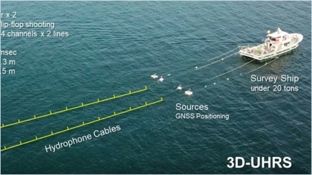
Compact 3D Acoustic Survey System
This geophysical survey technology enables 3D acoustic imaging of the seabed through vessel-towed operations. Designed for versatility, the system can be deployed from smaller vessels than conventional systems while maintaining high-resolution subsurface imaging performance.
-
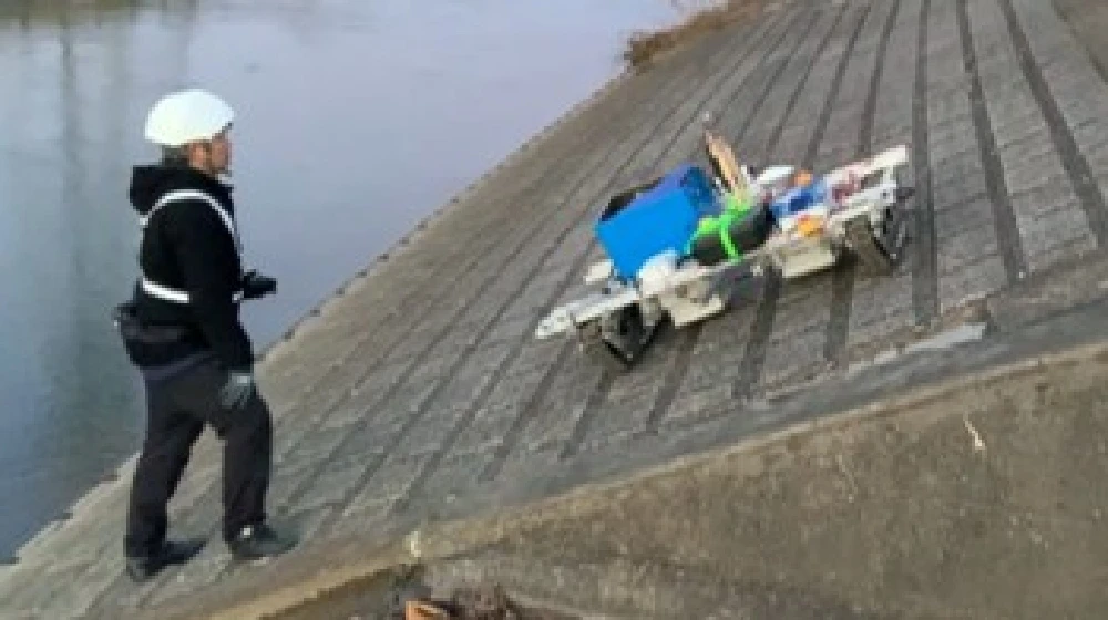
GPR Survey Robot for River Revetments and Port Quay Walls
This ground-penetrating radar (GPR) rover enables wireless detection of subsurface voids on river revetments and port quay walls. By inputting predefined survey line coordinates, the system can perform autonomous surveys.
-
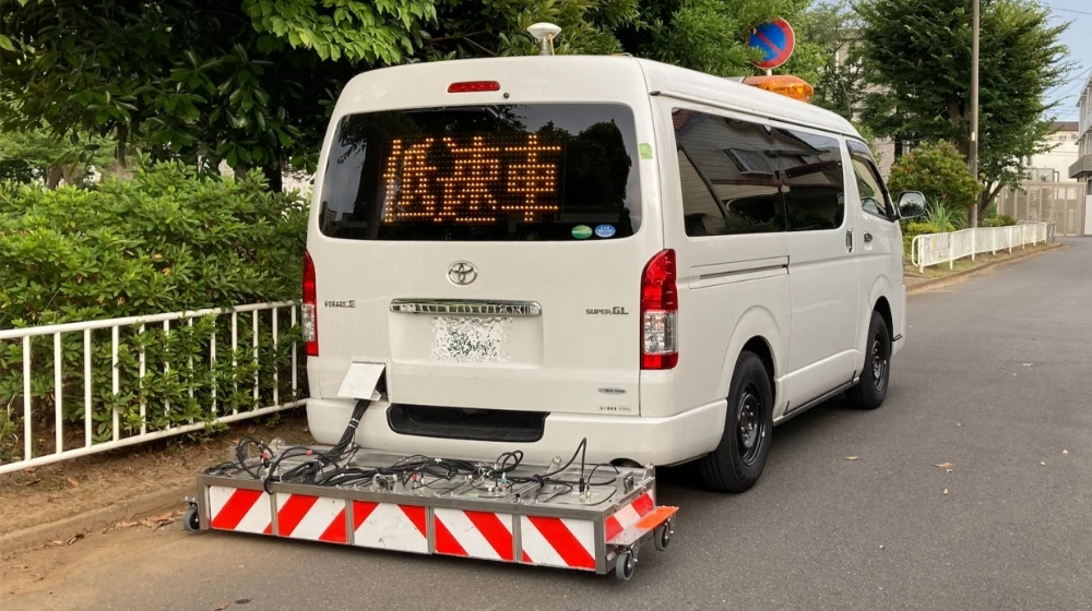
Vehicle-mounted Chirp Radar Survey System
This Vehicle-mounted Chirp Radar Survey System is equipped with an in-house developed chirp-type ground-penetrating radar (GPR). It offers a key advantage in detection depth, enabling void detection at depths of up to approximately 2 meters.
List of Patents
| Filing Date | Registration Date | Patent No. | Title of the Invention |
|---|---|---|---|
| 2022.02.15 | 7096561 | Attachment for Structure Installation and Installation Method Using the Attachment | |
| 2021.02.02 | 7580226 | FMCW Ground-Penetrating Radar System | |
| 2021.02.02 | 7490588 | Ground-Penetrating Radar System for Shield Tunneling Machines | |
| 2016.08.29 | 6723111 | Gravity Measurement Device | |
| 2015.08.04 | 6420218 | Subsurface Analysis Method | |
| 2014.05.21 | 6390025 | High-Frequency Vibration Detection Device | |
| 2011.12.09 | 5326177 | Portable Cone Penetration Test Device | |
| 2011.06.13 | 5789132 | Muon-Based Multi-Sensor Ground Investigation System | |
| 2011.06.13 | 5789133 | Muon-Based 3D Ground Investigation System | |
| 2010.02.24 | 5543239 | Heat Supply System for Cultivation Facilities |









Contact
Please feel free to contact us for inquiries regarding quotations and orders,
public relations and investor relations, as well as our products and services.
For immediate assistance, please call us.
Business Hours 9:00–17:30 (excluding weekends and public holidays)